
What Happened in Rasuwa on August 26, 2026?
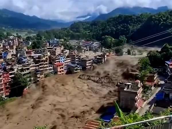
Just after 9 AM on August 16, a sudden outburst of water and debris came down from the Tibet side of the border and entered the Lhende Khola, a high-altitude river that flows south into Nepal. The flood then moved into the Bhote Koshi system, hitting the Rasuwagadhi-Timure corridor with enough force to destroy roads, bridges, settlements, and hydropower infrastructure before the floodwaters continued downstream.
What triggered that surge is more complicated than simply calling it a “glacial lake outburst flood.” Early reports considered an earthquake, an ice avalanche, and a temporary blockage of the Lhende River, with some initial assessments describing a possible GLOF. The subsequent satellite evidence and scientific analysis have pointed more strongly towards a massive collapse of glacier ice and rock into the valley, which blocked or disrupted the river and generated the enormous downstream flood wave.
The geography helps explain why the damage spread so quickly. The Lhende Khola flows into the Bhote Koshi River, which then feeds the Trishuli River. From the initial impact around the northern Rasuwa corridor, the flood moved through areas including Rasuwagadhi and Timure, affected Syabrubesi, and continued south through the Trishuli system into downstream districts.
For someone looking at a map of Nepal, the important point is that this was not a single isolated riverbank. A high-mountain collapse created a wave that followed an interconnected river corridor, carrying water, ice, mud, and rock far beyond the original impact zone. Reports indicate that theTrishuli’s water level roseby as much as 9 meters within about 30 minutes during the event.
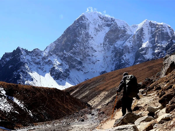
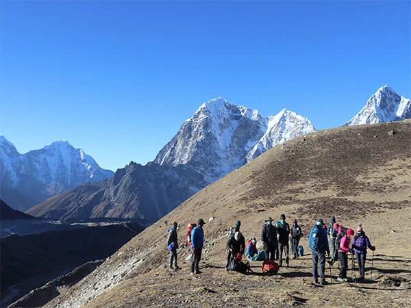
That destination also matters for trekkers. Rasuwagadhi, Langtang, and the Bhote Koshi corridor are directly relevant when accessing northern trekking areas, but the fact that this disaster happened in Nepal does not mean every trekking region in the country was affected.
The situation has to be assessed route by route, which is why the conditions of the actual Langtang access corridor matter more than just giving a statement that “Nepal trekking is unsafe for 2026.”
Timeline: How the Rasuwa District Unfolded
The Rasuwa disaster changed from a sudden flood into a much wider search and rescue operation over the following four days. New areas became reachable, casualty figures were revised, people were pulled from dangerous locations, and then a second flood threat complicated the response.
August 26 - The flood strikes without warning
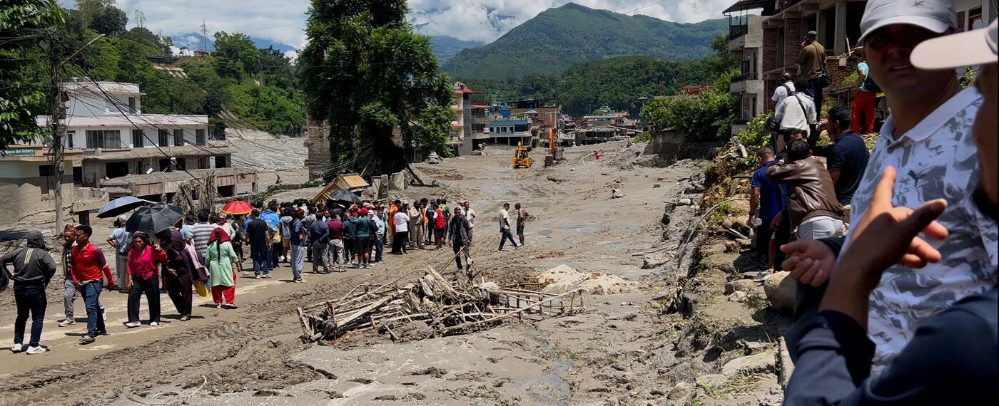
The disaster began on Wednesday morning when a powerful flash flood entered the Bhote Koshi river system in northern Rasuwa. The first reports came from around Rasuwagadhi and Timure, where floodwater carrying mud, rocks, and debris tore through the river corridor and damaged buildings, roads, bridges, and other infrastructure.
Rescue teams from the Nepal Army, Armed Police Forces, and Nepal Police began moving towards the affected areas, but damaged roads and communications made access difficult. For authorities, the first day was mainly about reaching people and understanding what happened. Initial casualty and missing people figures were therefore incomplete, and changed as more information came in from different communities.
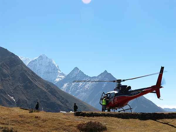
Helicopters became particularly important as roads and bridges could no longer provide a reliable route for rescuers.
August 27 - The scale of the disaster becomes clearer
By Thursday, August 27, rescue teams were reaching more locations, and the reported death toll was rising as bodies were recovered from Rasuwa and downstream districts. By Thursday evening, reports cited 389 confirmed deaths in Nepal, although other agencies were still working with much lower figures because their information had been collected earlier. Hundreds of people were also reported missing or out of contact.
More than 13,295 security personnel were deployed around the Bhote Koshi and Trishuli corridors, while helicopters were used to evacuate people from communities that could not be reached safely by road. The situation around Syabrubesi, Timure, and other northern Rasuwa settlements remained difficult because bridges and sections of the road network had been damaged.
The Nepal Red Cross was citing an NDRRMA figure of 157 deaths and 826 missing in its August 27 situation report, while police figures later that same day put the national death toll at 389.
August 28 - A second danger emerges
The threat was serious enough that rescue activity was temporarily interrupted in some areas. The residents were moved away from exposed river sections while authorities monitored the situation. The late surge was reported to be nowhere near the scale of the original disaster, but for people already displaced by the first flood, the possibility of another wave added a new layer of danger.
The Nepal Army brought 350 workers and local residents out of an Upper Trishuli hydropower tunnel, while teams also evacuated hundreds of people from difficulty-to-reach places including Syabrubesi, Timure, Mailung, Thulo Kalu, and Hakubesi.
More missing-person reports were being added, foreign nationals were being identified among those rescued, and the conditions of roads and river crossings continued to hamper access to some of the worst-hit areas.
August 29 - Rescue meets difficult terrain
By August 29, the operation had spread well beyond the original flood zone. Search teams were checking damaged settlements, riverbanks, and hydropower facilities while helicopters continued carrying people from isolated communities. The government reported that 4,451 survivors had been rescued, with private and military helicopters conducting repeated flights into affected areas.
The hydropower sector remained a particular concern because workers had been trapped inside tunnels and some facilities had suffered severe damage. Even the authorities were checking information from families, local officials, and security agencies while continuing searches in places that had only recently become accessible.
August 30 - the search continues, and the numbers are still moving
By Sunday, the operation had entered its fifth day. As of August 30, Reuters reported 734 confirmed deaths in Nepal and nearly 2,500 people missing. The same report put the combined death toll in Nepal and Tibet at least 750, with more than 3,000 people missing across the two sides of the border.
The NDRRMA’s current Rasuwa flood record lists 2,498 people still out of contact, while thousands of people have already been rescued and evacuated. By 7 AM Sunday, the Nepal Army said it had evacuated 2,697 people from flood-affected parts of Rasuwa and another 200 were rescued by ground teams.
But even on August 30, conditions could still interrupt the operation. Heavy rain temporarily halted work to locate the entrance to the Trishuli Hydropower Project’s 3A tunnel after the water level rose and flooded excavation areas.
Government Relief and Rescue Efforts
- On August 26, Prime Minister Shah directed the security agency and emergency teams to intensify rescue and relief operations. The government also ordered downstream communities to be moved towards safer areas as the flood threat expanded.
- Security personnel were deployed for search, evacuation, and recovery operations. Army helicopters became important as the roads and bridges had been washed away or blocked. On the first day alone, the Nepal Army reported 88 people rescued by the helicopter.
- The government ordered free medical treatment for people injured in the Rasuwa flood, with treatment coordinated through government hospitals, the Ministry of Health and security agencies.
- On August 30, Finance Minister Wagle inspected the affected areas and said the government would provide the resources required for rescue, relief, medical care, and rehabilitation.
- As the scale of the disaster became clearer, Nepal also began receiving offers ot technical and emergency assistance from other countries, including support for specialized rescue operations and relief supplies.
The Barrier Lake Scare: What Happened Upstream?
After the first flood, another danger developed near the Nepal-China border. The ice, rock, and debris from the initial collapse blocked part of the river, allowing water to collect behind the debris and form a temporary barrier lake. Authorities feared that if the blockage failed suddenly, another rush of water could move down the Bhote Koshi and put affected communities at high risk.
A barrier lake is different from a normal glacial lake. It forms when debris such as rock, ice, or mud blocks a river, creating temporary water storage behind the blockage. In this case, authorities monitored the lake and downstream river levels because the stability of that natural dam could change quickly with additional rainfall.
The immediate concern eased after the lake began overflowing rather than failing in a catastrophic release, allowing rescue work to continue. However, the wider river system was still being watched on August 30.
Death Toll, Missing People, and Rescue Efforts
Figures are changing as search teams reach previously inaccessible areas, so the numbers below should always be read carefully. As of August 30, the Nepal Disaster Authority reported the death count to 734, while 2,498 people are still missing from the Nepal side.
The exact number of people missing is difficult to interpret, mainly for disasters like the Rasuwa Flood. Even conditions might arise where some may be alive but unreachable due to damaged communication lines, although the rescue team is trying their best to search and identify.
Military helicopters were used to reach the isolated communities, while other security forces and local teams have been deployed to go through the damaged areas, riverbanks, and hydropower tunnels.
Areas that were hit by the Rasuwa Flood?
The worst damage followed the Bhote Koshi-Trishuli river corridor rather than affecting Rasuwa evenly. The flood first hit Rasuwagadhi and Timure near the Nepal-China border, damaging the customs areas, road, bridges, buildings, and other infrastructure. From there, the flood travelled south through the Bhote Koshi towards Syabrubesi, one of the main gateways to the Langtang region.
Further downstream, the effect reached areas including Dhunche, Mailung, and Betrawati before continuing through the wider Trishuli River system. Damage was also reported in parts of Nuwakot and Dhading. The roads, bridges, hydropower projects, and communication links were heavily affected, which made transportation and rescue even more difficult during such a moment.
For trekkers, the situation around Syabrubesi needs main attention. The damage to the gateway and access roads does not mean the entire Langtang trail has been destroyed.
What Does the Rasuwa Flood Mean for Langtang and Gosaikunda Trekkers?
If you are planning Langtang or Gosaikunda, the biggest issue right now is not simply the conditions of the trail. It’s how you get there. Both routes depend on the access through Tasuwa, and the August 26 flood damaged roads, bridges, and other infrastructure around the district. That means the usual Kathmandu-Dhunche and Kathmandu-Syabrubesi journeys should be checked immediately before departure.
Don’t switch to Dhunche or another route because you heard it's open. The road may be passable for local traffic but not for tourists, jeeps, or trekking groups, especially where bridges or landslide-prone areas. Any alternative routes should be confirmed by your trekking agency, local authorities, or current transport operators.
Are Everest, Annapurna, Manaslu, and other trekking regions closed?
As we know, the disaster occurred in the Lhedne Khola-Bhote Koshi-Trishuli corridor. Other major trekking regions such as Everest, Annapurna, and Manaslu are different parts of the Himalayas with their own river systems and access routes. So, a flood in Rasuwa does not mean other trails have been affected.
For Everest, Annapurna, and Manaslu, the more important thing to know is what’s exactly happening on the specific route you plan to travel. Check for the conditions, road access, flights, lodges, and trail sections.
So, if you have a trek booked outside Rasuwa, there is no reason to cancel because of the Rasuwa disaster. Nepal’s mountain conditions can change quickly, and route-specific information from local authorities and an experienced trekking operator should be the final decision.
What Should Trekkers Do Before Travelling to Nepal?
The Rasuwa flood does not mean you need to cancel every trek in Nepal. What matters is the current conditions of your particular route. A few simple checks before departure can help you avoid unnecessary risk and last-minute problems.
- Look at the latest government, disaster-management, and travel advisories before travelling.
- Ask for a current, route-specific update rather than relying on general news.
- Check whether the road from Kathmandu to your starting point of the trek is actually operating.
- Find out whether bridges have been severely damaged, whether landslides or trail sections are accessible, and whether it affects the itinerary.
- Leave some extra buffer days in your itinerary in case any weather- or road-related problems may arise.
- Make sure you review your insurance, as it should cover trekking at your planned altitude and emergency evacuation.
- Don’t enter the restricted areas or active rescue sites just to see the damage.
- Conditions can change quickly, so confirm everything shortly before starting your trek.
Frequently Asked Questions for Rasuwa Flood 2026
- Is Rasuwa safe to visit after the August 2026 flood?
Not yet, no. The Bhote Koshi and Trishuli corridors took the worst damage, with roads, bridges, and other infrastructure heavily affected. Rescue operations are also still active in parts of the district. Check with local authorities or your trekking operator before planning any visit.
- Is Langtang Valley still possible to do even after the Rasuwa flood?
Not immediately. Syabrubesi, the main gateway to Langtang Valley, was heavily damaged in the August 26 flood, along with the roads and bridges leading to it. Trekking agencies are currently rerouting some trips through Dhunche instead, but this should be confirmed directly with your operator before you travel.
- Is Gosaikunda affected by the Rasuwa flood?
Gosaikunda should be assessed separately from the areas directly hit by the flood, but access through Rasuwa may still be affected. The roads are damaged, bridges have collapsed, and infrastructure is one of the important parts that can create difficulty for your Gosaikunda trip.
- Is Everest Base Camp affected by the Rasuwa flood?
The Rasuwa flood did not occur along the Everest Base Camp trekking corridor, so the areas are not affected. As Everest is in a different Himalayan region and river system, trekkers should still check for the weather, Lukla flight conditions, and local trail conditions.
- What caused the Rasuwa flood?
One of the major causes of the Rasuwa flood was a major ice and rock collapse near the Nepal-Tibet border line. That greatly disrupted the Lhende Khola and released a powerful rush into the Bhote Koshi system.
- Is the collapse the major reason for the Rasuwa flood?
Yes, a glacier and ice collapse is the primary reason. Nepal’s hydrology officials confirmed that there was no significant rainfall in the 24 hours before the flood. It was also said that a 5.2 magnitude shake was recorded at the same time, which made a large piece of ice and rock break down near Langtang Lirung and crash into the river below.
- What is the latest Rasuwa flood death toll?
As of August 30, 2026, reports put Nepal’s confirmed death toll from the disaster at 734 with nearly 2,498 people still missing. The exact figure remains provisional because search, recovery, and identification operations are continuing in areas that were difficult to reach after the flood.
- What happened to the Bhote Koshi River?
The Bhote Koshi carried a powerful torrent of water and debris downstream after the mountain collapse and river disruption near the Nepal-Tibet border. The resulting flood damaged settlements, roads, bridges, and hydropower infrastructure along parts of the river corridor before the flow continued into the Trishuli system.
- What happened at Rasuwagadhi and Timure?
Rasuwagadhi and Timure were among the first areas in Nepal hit by the August 26 flood. The sudden flood wave damaged buildings, roads, bridges, border facilities, and other infrastructure around the northern Rasuwa corridor.
- Is Syabrubesi accessible now?
For now, this section of the route is heavily damaged by the August 26 flood. Therefore, it is better to confirm the latest conditions with the local authorities or your trekking operator.
- Should I cancel my Nepal trekking trip?
You do not necessarily need to cancel your Nepal trip because of the Rasuwa flood. If your itinerary passes through Rasuwa, get a current route-specific assessment before travelling. But if you are heading to Everest, Annapurna, or another region, check that area’s conditions.
Sources and Further Reading
Because this is a developing disaster, the source list shows where the information came from and when it was reported. For changing figures such as deaths, missing people, and rescue numbers, better to check the sources below.