Shey Phoksundo Lake Lower Dolpo Trek
Lower Dolpo Trek
Lower Dolpo Trek Trail

Lower Dolpo Trek - 21 Days

31 reviews in Trip Advisor
11 reviews in Google Reviews
Recommended by 99% of travelers
Duration
20 Days
Trip Grade
Strenuous
Country
Nepal
Maximum Altitude
5,190 mt.
Group Size
2-15 Pax.
Starts
Kathmandu
Ends
Kathmandu
Activities
Trekking
Best Time
Spring and Autumn

Trip Overview for Lower Dolpo Trek 

The Lower Dolpo Trek is a 21-day camping trek through the remote Dolpo region of western Nepal in Karnali. On the initial days, the trail climbs from the lower valleys of Dolpo and moves further to Dho Tarap, and reaches the high passes of Numa La and Baga La. That change in altitude and terrain is what defines the journey. 

The Lower Dolpo reaches around 5,300 m at Numa La Pass, with Baga La Pass at around 5,070 m. Similarly, Dho Tarap sits around 4,092 m, which makes it a great place to rest and acclimatize before the route heads towards the high passes. 

The journey starts in Kathmandu and includes a domestic flight to reach Nepalgunj, followed by the next day to Juphal. From there, the route passes through Dunai, Tarakot, Lahini, Nawarpani and Dho Tarap before continuing across Ringmo and Shey Phoksundao Lake. After that, the return begins through Chhepka and Dunai and then to Juphal

This is a moderate to challenging trek that is even recognised as an off-the-beaten-track trek in Nepal. The route includes 5 to 8 hours of walking days, high-altitude pass crossings, and sections where you get limited amenities. So, it mostly suits travelers who are prepared for a more remote Himalayan experience. 

The main attraction is Shey Phoksundo Lake, reached after passing through Ringmo, but the route is more than a lake visit. Dho Tarap, Numa La, Baga La, and the remote Dolpo valleys and the gradual change from lower river valleys to high mountain terrain are all part of what makes this journey distinct. 

Important Highlights During the Lower Dolpo Trek - 21 Days

  • The route takes you through the demanding passes such as Numa La (5,190 m) and Baga La (5,070 m), where weather and altitude matter as much as fitness. 
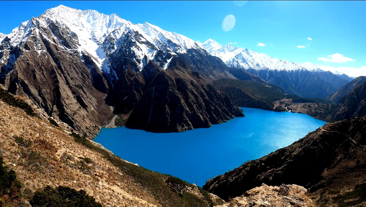
  • Reach the turquoise waters of Phoksundo Lake. This is not just a viewpoint on the itinerary. You walk down towards the lake and see the water appear through the surrounding cliff. 
  • Walk through one of Nepal’s most isolated trekking regions, as the route starts to feel genuinely remote in comparison to popular Everestand Annapurna treks
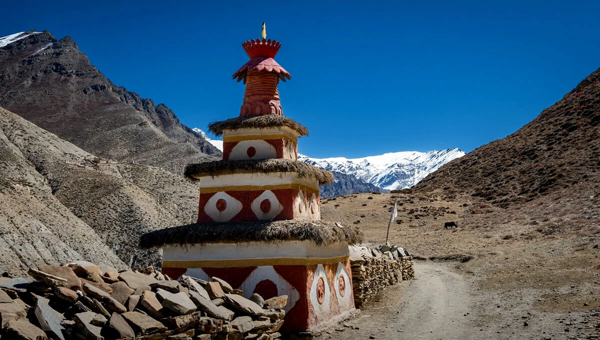
  • In places such as Ringmo and Dho Tarap, experience the Tibetan-influenced culture of Dolpo. On the way, you get to see Buddhist monasteries, mani walls, prayer flags, and traditional settlements that add beauty to the trek. 
  • Explore Dho Tarap at around 4,000 meters, as the surroundings here start to feel different from the lower forested sections and open valleys. 
  • The scenery changes as you gain altitude. While the lower sections can involve pine and juniper forests, the higher passes open into rocky and wind-exposed terrain. 
  • Camp beneath much quieter Himalayan trails as most nights on the route are spent away from the villages and teahouses. 

Outline Itinerary for Lower Dolpo Trek 21 Days

Day 01: Arrival at Tribhuvan International Airport in Kathmandu (1,400 m / 4,593 ft) and transfer to your hotel. Overnight at a 3-star hotel. 

Day 02: Trek preparation day in Kathmandu (1,400 m / 4,593 ft), including a trek briefing and final equipment check. You can also explore parts of Kathmandu Valley during your free time. 

Day 03: Morning flight from Kathmandu to Nepalgunj (150 m / 492 ft) - 45 to 50 minutes. Upon arrival, pickup and transfer to your hotel. Overnight at the hotel. 

Day 04: Flight from Nepalgunj to Juphal (2,500 m / 8,202 ft) and trek to Dunai (2,140 m / 7,021 ft) - 2 to 3 hours. Overnight at a teahouse. 

Day 05: Trek from Dunai to Tarakot (2,560 m / 8,399 ft) - 5 to 6 hours. Follow the valley and Bheri River through rugged surroundings before reaching Tarakot. 

Day 06: Trek from Tarakot to Lahini (3,160 m / 10,367 ft) - 5 to 6 hours. Continue deeper into the valleys as the trail gains elevation. 

Day 07: Trek from Lahini to Nawarpani (3,480 m / 11,417 ft) - 5 to 6 hours. The route continues through a quieter mountain valley with a steady climb towards Nawarpani. Overnight at a campsite. 

Day 08: Trek from Nawarpani to Dho Tarap (4,092 m / 13,425 ft) - 7 to 8 hours. Walk through the increasingly dry and open landscape of the Tarap Valley. 

Day 09: Rest and Acclimatization day at Dho Tarap. Take a short walk around the valley, explore traditional settlements, and allow your body to adjust before heading towards the high mountain passes. 

Day 10: Trek from Dho Tarap to Numa La Base Camp (4,460 m / 14,633 ft) - 6 to 7 hours. Leave the Tarap Valley and continue through increasingly rugged high-altitude terrain. 

Day 11: Trek from Numa La Base Camp to Danigar (4,500 m / 14,764 ft) via Numa La Pass (5,300 m / 17,388 ft) - 7 to 8 hours. Cross the highest pass of the route before descending towards Danigar. 

Day 12: Trek from Danigar to Yak Kharka (3,860 m / 12,664 ft) via Baga La Pass (5,070 m / 16,634 ft) - 6 to 7 hours. Climb towards the second major pass. 

Day 13: Trek from Yak Kharka to Ringmo (3,600 m / 11,811 ft) - around 4 hours. Leave the high-pass section behind and descend towards the greener surroundings of Ringmo village.

Day 14: Trek from Ringmo to Shey Phoksundo Lake (3,612 m / 11,850 ft) - 5 to 6 hours. Continue through the mountain landscape towards the shores of Phoksundo. 

Day 15: Explore Shey Phoksundo Lake (3,612 m / 11,850 ft). Spend the day exploring the lake surroundings and Ringmo area, with time for shorter walks and enjoying the landscape. 

Day 16: Trek from Shey Phoksundo Lake to Chhepka (2,670 m / 8,760 ft) - 5 to 6 hours. Begin the descent through forested sections and mountain valleys as the route returns towards lower elevations. 

Day 17: Trek from Chhepka to Dunai (2,150 m / 7,050 ft) - 5 to 6 hours. Continue through the lower valley and surrounding settlements before returning to Dunai. 

Day 18: Trek from Dunai to Juphal (2,480 m / 8,136 ft) - 3 to 4 hours. Complete the final walking section of the journey and return to Juphal. 

Day 19: Flight from Juphal to Nepalgunj (150 m / 492 ft) - 35 to 45 minutes, followed by a return flight from Nepalgunj to Kathmandu (1,400 m / 4,593 ft) - 45 to 50 minutes. Transfer to your hotel after arriving in Kathmandu. Overnight at a 3-star hotel. 

Day 20: Buffer day in Kathmandu (1,400 m / 4,593 ft), kept available in case the Juphal-Nepalgunk flight is delayed or cancelled. 

Day 21: Final departure from Kathmandu (1,400 m / 4,593 ft). After breakfast, transfer to Tribhuvan International Airport according to your international flight schedule.  

What makes the Lower Dolpo Trek different?

After walking for a few hours in Lower Dolpo, the difference becomes pretty obvious. On some days, you are walking for hours without any little shops or lodges that you easily find on the more established trekking routes in Nepal. 

Trekking Lower Dolpo in the western part of Nepal gives a drier side of the Himalayas, so the landscape changes as you climb. You get forests in the lower valleys, the open hillsides, grey rocks, dusty trails and those huge slopes. Camping is still a major part of the journey. You don’t finish the walking day and start looking for the nicest teahouse in the village. 

Instead, the trekking crew carries what the group needs, camp is set up along the route, and evenings usually feel much quieter than the Everest or Annapurna trails. This lets you understand trekking in Dolpo most simply. The first proper view of Phoksunda Lake is one of those moments where the walking almost stops for a minute. The water sits below the surrounding cliffs with Ringmo village close by. 

Crossing Numa La at about 5,190 meters and Baga La at about 5,070 meters is a serious part of the route. The altitude matters here because these are not just the highest points, but you spend time above 5,000 meters, often in exposed terrain where wind and weather can be harder. 

That’s what makes this route different. The Lower Dolpo trek is simply a part of the country where travel still takes time, the landscape keeps on changing as you climb, and it offers a sense of remote wilderness trekking. 

Is the Lower Dolpo Trek Right for You?

The Lower Dolpo Trek suits people who are comfortable with remote trekking, long walking days, and camping accommodations. While having prior experience can be helpful to navigate through the route, it is not compulsory; in fact, you can gain great experience on this trekking trail. 

This Dolpo region trek might not be suitable if you want cozy accommodation stays, regular WiFi, electricity, ATMs, and frequent rest stops along the way. For them, Everest Base Camp or Annapurna Base Camp Trek might be a better alternative. You also need to be careful because most flights to Juphal are fully dependent on the weather conditions, which causes delays during unfavorable months. 

The main difficulty of the Lower Dolpo trek comes mainly from long walking days, high-mountain remote trails, rough as well as uneven paths offering limited facilities. A completely beginners can also be capable of completing the route with appropriate training, a well-designed itinerary, enough acclimatization time, and good support. 

The biggest issue is preparation. If this is your first serious trek, you need to understand what things can be challenging on the route. For an experienced trekker, the same conditions may be a simple part of the route. 

Lower Dolpo Trek Routes and Major Places 

The Lower Dolpo trek route starts with the flight to Juphal, followed by a trek to Dunai and Tarakot before heading deeper into the Dolpo region. From Tarakot, the trail continues towards Lahini, Nawarpani, and the dry Tarap Valley, reaching Dho Tarap at around 4,000 meters. 

From Dho Tarap, the route climbs towards Numa La Pass (5,190 m) and descends to Danigar before crossing Baga La Pass. The trail then continues through Yak Kharka to Ringmo, where the landscape changes again as you approach Shey Phoksundo Lake. 

After Phoksundo, the trail descends through Chhepka before returning towards Dunai and Juphal. This gives the lower Dolpo trekking route a clear movement from lower valleys, high-altitude passes, the Tarap Valley, and finally Phoksundo. 

Lower Dolpo Trek Cost for 2026/2027 

The Lower Dolpo trek cost heavily depends on the group size; the price decreases as the group gets larger. This is only because some trekking and camping logistics can be easily shared between the trekkers, which makes it even more affordable for you. Before you book, make sure the Lower Dolpo trek package covers domestic flights, permits, accommodation, meals, porter support, and camping arrangements. 

Group Size Price per Person
1 Person US$
2 - 4 people US$
5 - 10 people US$
11 - 15 people US$
16 - 20 people US$

It is equally important to check what is excluded from the Lower Dolpo trek price. Most of the time, personal expenses, travel insurance, tips for the guide, porter, and trekking crew, and other additional costs such as charging devices at teahouses are paid separately by trekkers.

Lower Dolpo Trek Difficulty and Fitness Requirements 

The Dolpo region trek difficulty comes from several things. You have long walking days, repeated climbs, gradual descents, high mountain passes, and camping for several days on the trail. Even the remote environment has fewer facilities. 

The hardest sections are usually around Numa La and Baga La, where the climbs to high mountain passes and terrain can be steep and rough. Weather changes are also equally a challenge, mainly during your ascent to the high passes. This is why the Lower Dolpo trek difficulty does not come from the daily distance. 

Therefore, for a safe Lower Dolpo trip, fitness makes it even easier. You don’t need to train like an athlete, but you should be building good endurance before the journey. Start your Lower Dolpo trek preparation by focusing more on several hours of walking, climbing uphills, and recovering well enough to walk the next day again. 

Best Time for the Lower Dolpo Trek 

The best time for the Lower Dolpo trek is generally spring and autumn. Even summer can be a good time because it lies in a rain-shadow part of Nepal. This keeps much of the region drier even during the monsoon than many other popular trekking routes. 

Spring (March-May) brings warmer days and improving trail conditions. While snow can remain around the higher passes in the early season. The lower Dolpo trek in autumn (September-November) usually has clearer skies and great mountain visibility, although nights can feel colder in the season. 

The Lower Dolpo trek in monsoon can be possible, especially in the drier upper valleys, but flight to Juphal may still be delayed due to cloud and weather. So, it is highly recommended to allow some extra time, as it matters during such situations. 

Winter brings colder temperatures and higher chances of snowfall around the mountain passes. So, for most trekkers, spring and autumn are the easiest balance of weather, visibility, and high pass conditions. 

Why Book Your Lower Dolpo Trek with Us?

Planning Lower Dolpo requires more than arranging accommodation and flights. Our team handles the practical side of the journey, including permits, transportation, trekking staff, and pre-trek preparation, so you know what to expect before leaving Kathmandu. 

  • High Camp Adventure presents as having 25+ years of experience, while the company’s guides have been leading people in the Himalayas for over a decade. 
  • Our company is Government-registered and is licensed by the Nepal Tourism Board and Department of Tourism. 
  • High Camp Adventure is listed as a member of the Trekkers Agencies Association of Nepal (TAAN) and a general member of the Nepal Mountaineering Association (NMA). 
  • Our guides have extensive Himalayan experience and are registered and licensed by the government. 
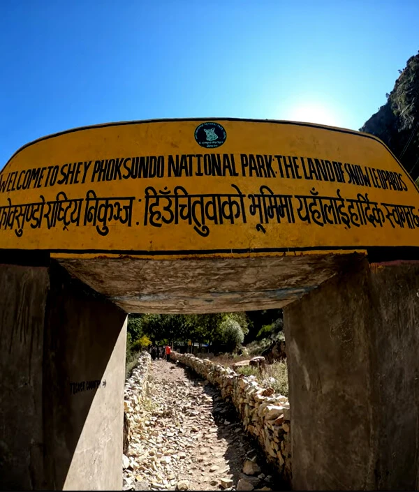
  • On behalf of trekkers, our team will help you obtain all the necessary permits and handle the paperwork, including the Shey Phoksundo National Park permit. 
  • Your logistics are well-planned by our team, including transportation, meals, trekking staff, and mainly camping-related arrangements. 
  • We provide 24/7 assistance, as you can directly contact us through phone, WhatsApp / Viber, or via email for your trip planning. 
Lower Dolpo Trek - 21 Days Itinerary

Start Point: Kathmandu
End Point: Kathmandu
Expand All

As you arrive at the Tribhuvan International Airport in Kathmandu, you will be greeted by one of our team representatives. After your warm welcome, you will be transferred to your hotel in the Thamel area, which is known to be a major spot for trekkers and travelers. Thamel is mostly packed with many restaurants, shops, bars, and cafes. In the evening, you can explore the nearby areas and take a short walk to Thamel and relax. 

Max Altitude: 1,400 m (4,593 ft)Meals: Bed & BreakfastAccommodation: Hotel

After breakfast, you will be provided with options to either spend the day on trek preparation or explore some of the major UNESCO World Heritage Sites in Kathmandu. You will be visiting some of the major sites such as Swyambhunath Stupa (Monkey Temple), Boudhanath Stupa, Pashupatinath Temple, and Durbar Square, which offer you chances to witness the rich cultural heritage, temples, and old palaces. After the full day of sightseeing, you will return to the hotel, where you will relax, enjoy your delicious dinner, and prepare yourself for the trek.

Max Altitude: 1,400 m (4,593 ft)Meals: Bed & BreakfastAccommodation: Hotel

After having your breakfast at your hotel in Kathmandu, you will be heading towards the Domestic Terminal (TIA) for your flight to Nepalgunj. The flight from Kathmandu to Nepalgunj takes approximately 1 hour, depending on the weather conditions. The flight to Nepalgunj rewards you with aerial views of the landscapes as you navigate over the foothills. Upon reaching Nepalgunj Airport, you will be welcomed by our team representative and transferred to your designated hotel. Nepalgunj is a vibrant town, situated in the Terai region, close to the Indian border, lying at an elevation of around 150 meters. Nepalgunj serves as the entry point to regions like Dolpo. You can spend some time exploring the small markets to witness the different local cultures of this town.

Max Altitude: 150 m (493 ft)Meals: Breakfast, Lunch & DinnerAccommodation: Hotel

Today, you will be flying from Nepalgunj to Juphal, and after breakfast at your hotel, you will proceed towards the Nepalgunj Airport. The flight from Nepalgunj to Juphal is short, with 25-30 minutes, depending on the weather conditions. The flight offers you some spectacular views of the Himalayas as you ascend into the mountain region. You will be passing through rugged terrain and dramatic landscapes as you near Juphal. As you land in Juphal, you will begin your trek to Dunai, the headquarters of Dolpa District. The route passes through traditional villages, terraced fields, and small settlement areas, where you get to witness stone houses. Your route passes along the Bheri River, offering you impressive views of the river valleys and mountains from a distance. Approaching Dunai, a small and picturesque village in the Dolpo region, serves as the entry point to the remote areas of this district. Relax and explore the village while you get an opportunity to interact with the locals of the area. 

Max Altitude: 2,480 m (Juphal) and 2,140 m (Dunai)Meals: Breakfast, Lunch & DinnerAccommodation: Teahouse

You will start your journey from Dunai to Tarakot, a historic settlement area located at an elevation of 2,560 M (8,366 ft). The trail navigates along the Bheri River, taking you through a combination of rocky as well as forested paths. As you trek higher, the landscape changes to a more rugged and isolated area, providing stunning views of the nearby mountains. Along the route, you will pass through several small villages, where you can witness the local way of living, offering you a sense of traditional lifestyle in the Dolpa region, with stone houses and terraced fields. The trek involves crossing several small wooden and suspension bridges over the Bheri River. Upon reaching Tarakot, a charming village that lies on the bank of the Bheri River and is a major cultural and historical site of the Dolpo region, you can witness ancient monasteries. The village is mostly surrounded by incredible scenery, with a river flowing nearby, and offers panoramic views of the majestic Himalayas.

Max Altitude: 2,560 m (8,398 ft)Meals: Breakfast, Lunch & DinnerAccommodation: Teahouse

Making your ascent from Tarakot to Lahini starts by following the Bheri River, where you make your way through dense forests, terraced fields, and small settlement areas. As you leave Tarakot, you will see a gradual change in the landscape as it becomes more rugged, with a river valley. The trekking route rewards you with stunning views of the nearby mountain peaks and valleys, where you cross through rocky trail sections. The trail passes along several settlement areas, where you can observe the different lifestyles of the locals, who are mainly into agriculture and animal husbandry. Lahini is mostly included in the Buddhist culture, where you can see small stupas and prayer flags along the route. Once you arrive in Lahini, you can take some time to relax and enjoy the tranquil surroundings, along with making your visit to some of the local monasteries. 

Max Altitude: 3,160 m (10,367 ft)Meals: Breakfast, Lunch & DinnerAccommodation: Teahouse

The trek from Lahini to Nawarpani includes some gradual ascent through dense forests, which provides you with dazzling views of the Bheri River valley and the other nearby surrounding peaks. The trail proceeds through a combination of dense pine forests, which provide you with a serene environment. You will also be passing through small settlement areas, where you can see local villagers practicing traditional agricultural methods. As you gain elevation, you will be offered remarkable views of snow-capped peaks and some glimpses of the mountain ranges. As you near Nawarpani, your route will follow along the river valleys, crossing several small streams, and making your way alongside the Bheri River. Reaching Nawarpani, you will be offered a serene environment, where you can see some changes in the landscape as you ascend. Nawarpani is a great place to rest and acclimatize yourself to the higher altitude.

Max Altitude: 3,480 m (11,417 ft)Meals: Breakfast, Lunch & DinnerAccommodation: Teahouse

Trekking from Nawarpani to Dho Tarap starts with a significant altitude gain through stunning landscapes and cultural experiences, making today’s journey rewarding. Leaving from Nawarpani, you trek towards more remote and rugged terrain with some rocky hills and high-altitude meadows. As you gain elevation, you will be rewarded with panoramic views of surrounding mountains and valleys. The landscapes become more barren with fertile regions, offering you impressive vistas of snow-capped peaks from a distance, along with the view of Kanjiroba Himal (6,500 M). You will get an opportunity to see yaks and shepherds grazing in the area, along with chances to witness Tibetan-style stone houses as you near Dho Tarap. Reaching Dho Tarap, the largest settlement area in the region, which is home to the Tibetan Buddhists. This place is full of ancient monasteries, where you can see mani walls, prayer flags, and monasteries around the village. Upon reaching Dho Tarap, you will have enough time to rest and explore the village as well as chances to interact with the locals. 

Max Altitude: 4,092 m (13,425 ft)Meals: Breakfast, Lunch & DinnerAccommodation: Teahouse

Today is a rest day provided to you, especially for acclimatization to help your body adjust to a higher altitude. You will be spending this day exploring the village and the beautiful surroundings of this remote Tibetan Buddhist area. Prepare yourself to visit the Dho Tarap Monastery, a crucial religious site in the area, where you can see beautiful architecture, prayer wheels, and various statues. This day offers you an excellent opportunity to learn more about the Tibetan Buddhist practices in the area and chances to interact with the locals about their local customs, traditions, and lifestyle. Take a short walk around the village and explore the traditional stone houses, mani walls, and prayer flags. Spend your time relaxing and enjoying the peaceful surroundings. This day is perfect to experience the unique culture and stunning natural beauty of Dho Tarap, one of the most remote and scenic locations in Nepal.

Max Altitude: 4,092 m (13,425 ft)Meals: Breakfast, Lunch & DinnerAccommodation: Teahouse

The trek starts with a gradual ascent, where you will be winding through high-altitude meadows, grazing lands, and rock ridges, which provide you with magnificent views of the surrounding mountains and valleys. The trek from Dho Tarap to Numala Base Camp will be challenging, as there will be significant altitude gain through remote and rugged terrain. As you move forward, you will make your way through a variety of landscapes, from grassy meadows to barren rocky terrain. The views of snow-capped mountain peaks of the Numala Range will provide you with awe-inspiring vistas. Along the way, you get to encounter several wildlife such as Himalayan blue Sheep and Yaks. Approaching Numala Base Camp, a peaceful and quiet spot, offering impressive views of the Numala Himal and other rugged peaks. This base camp serves as the perfect spot to relax and enjoy the surroundings with a delicious prepared meal.

Max Altitude: 4,860 m (15,944 ft)Meals: Breakfast, Lunch & DinnerAccommodation: Tented Camp

Making your way from Numala Base Camp to Danigar via Numa-La Pass is the longest and most challenging part of the Lower Dolpo trek. The starting phase of the route includes some steady climbs through rocky and high-altitude terrain, where the air gets thinner. As you pass through Numa-La pass, you will be amazed by the impressive panoramic views of snow-capped peaks and surrounding valleys, making your trek full of unforgettable memories. Make sure to maintain your pace and stay hydrated to prevent altitude sickness. After you approach the Numa-La pass, spend some time praising the beautiful landscapes along with the spectacular vistas of mountains and peaks. You then begin your descent towards the Danigar, a famous remote location known for its rugged landscapes, where you can get well-deserved experiences of the Buddhist culture and interact with unique Tibetan-influenced villages. You will be passing through dense forests, where you can witness sudden changes in the landscape as you descend. 

Max Altitude: 5,300 m (17,388 ft)Meals: Breakfast, Lunch & DinnerAccommodation: Teahouse

The trek from Danigar to Yak Kharka through the Bagala Pass is a challenging yet scenic route, where your descent starts after crossing the Bagala Pass to Yak Kharka. Making your way from Danigar involves a steep climb toward the Bagala Pass, which can be strenuous due to gradual altitude gain and rocky terrain conditions. After reaching the Bagala Pass, utilize your time to enjoy the breathtaking panoramic views of snow-capped peaks and valleys. As you descend towards Yak Kharka, a small settlement area known for its grazing lands for yaks. The descent is easier, as the trail is well-managed. Reaching Yak Kharka, you can rest and immerse yourself in the peaceful surroundings.

Max Altitude: 5,070 m (16,634 ft)Meals: Breakfast, Lunch & DinnerAccommodation: Teahouse

You will hike from Yak Kharka to Ringmo, a short but enjoyable trek, passing through scenic valleys and dense forests. The trail is mostly well-maintained, with some gentle descents. The trail winds through various valleys and forests, offering you incredible views of rocky hills and green meadows. As you descend towards Ringmo, you will notice a sudden change in the landscape from lush green areas to wider and open spaces, rewarding you with impressive views of the Kanjiroba Himal range, reaching Ringmo, a picturesque village lying near the edge of the Shey Phoksundo Lake.

Max Altitude: 2,960 m (9,711 ft)Meals: Breakfast, Lunch & DinnerAccommodation: Teahouse

Today’s journey takes you to the heart of Dolpo’s beauty, Shey Phoksundo Lake. The trail from Ringmo is a peaceful and scenic one, taking you through alpine forests and rocky landscapes. As you approach the lake, the turquoise-blue water comes into view, sparkling below towering cliffs and snow-covered peaks. Surrounded by peaceful and dramatic terrain, Phoksundo feels sacred, as the glacial lake is untouched and pristine, considering it to be one of Nepal’s natural wonders and a truly unforgettable highlight of the trek.

Max Altitude: 3,612 m (11,850 ft)Meals: Breakfast, Lunch & DinnerAccommodation: Teahouse

Today, you will be exploring the Shey Phoksundo Lake, which is well-known for its breathtaking beauty and serene surroundings. The paths around the lake are mostly easy, with only a few gradual inclines and declines, where the route is well-maintained. The lake is located at 3,590 meters, surrounded by towering peaks, such as the impressive Kanjiroba Himal to the north and the Phoksundo Himal to the east. The vibrant turquoise lake water provides a stunning contrast to the rugged and snow-capped peaks, making it an ideal location for photographers. A few small monasteries in the area provide you with a chance to immerse yourself in the local Tibetan culture. This day is perfect for relaxing and appreciating the breathtaking scenery, and enjoying the incredible natural beauty with a peaceful ambiance.

Max Altitude: 3,612 m (11,850 ft)Meals: Breakfast, Lunch & DinnerAccommodation: Teahouse

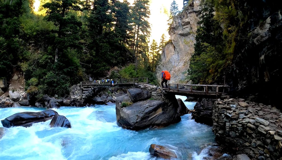
Trekking from Shey Phoksundo Lake involves a gradual descent, taking you through a mix of dense forest areas. As you pass along the route, you can witness a major shift in the landscape, which becomes more lush and vibrant. The trail navigates through small Tibetan-style villages, where you can observe the local way of life and interact with the locals. As you leave the high-altitude lake region, the views of the snow-capped Kanjiroba Himal peaks begin to fade, transforming into lush and greener surroundings. Some sections of the trek pass along the Phoksundo River, with the relaxing sound of flowing water guiding you during your descent. Chhepka, situated at an elevation of 2,670 meters, is a tranquil village surrounded by forests and river valleys, offering calm and peace after a day of trekking.

Max Altitude: 2,670 m (8,759 ft)Meals: Breakfast, Lunch & DinnerAccommodation: Teahouse

The journey from Chhepka to Dunai offers you a mix of descents and moderate climbs. The trail is generally favorable, though a few sections may be rocky or slippery. As you descend, the landscape changes from dense forests into open valleys and cultivated fields. Along the route, you will cross various villages where locals are mainly engaged in livestock and farming of the land. As you approach Dunai, a vibrant village with stone houses and a few small shops. This palace is known to be the key hub for trekkers and locals, offering a great place to relax before continuing the next trek. Dubai also has several Tibetan Buddhist monasteries, enhancing the cultural significance of the area.

Max Altitude: 2,150 m (7,053 ft)Meals: Breakfast, Lunch & DinnerAccommodation: Teahouse

Proceeding from Dunai to Juphal begins with a gentle descent along the Dunai River. The trekking route is usually well-maintained, making today’s journey more relaxing. Throughout the route, you will pass through terraced fields, small villages, and scattered settlements where locals are seen farming or herding livestock. As you move forward, the landscape changes into more of one with rhododendrons and pine trees. After trekking for about 3-4 hours, depending on your pace of way, you reach Juphal, a small town that serves as the gateway for trekkers coming in and out of the Dolpo region. The surrounding atmosphere here is more vibrant and quiet. Freshen up and spend some time relaxing and reflecting on your experiences in the Dolp region, with a feeling of achievement after completing the unforgettable trek.

Max Altitude: 2,480 m (8,136 ft)Meals: Breakfast, Lunch & DinnerAccommodation: Teahouse

The flight from Juphal to Nepalgunj typically takes around 25-30 minutes, depending on the weather conditions. During the flight, you will be offered breathtaking views of the mountains and landscapes along with the lowland region of Nepalgunj. The flight from Juphal to Nepalgunj can get delayed sometimes, because of the weather, but the journey provides you thrilling experience. After you land in Nepalgunj, you will be taking a connecting flight to Kathmandu. This flight usually takes approximately 1 hour, which rewards you with flying over the plains of the Terai region as well as some dazzling views of the surrounding hills. Once you arrive in Kathmandu, you will be transferred to your hotel to relax and reflect on your incredible trek through the Dolpo region.

Max Altitude: 1,400 m (4,593 ft)Meals: Bed & BreakfastAccommodation: Hotel

This day is set as a buffer day to accommodate any possible flight delays or cancellations due to bad weather conditions. Flights from remote locations such as Juphal and Nepalgunj frequently depend on the weather conditions, where there are chances of possible delays or cancellations, mainly during the monsoon season or when mountain visibility is low. This buffer day is provided to make sure you catch your connecting flight from Nepalgunj to Kathmandu. If your flight goes as per the schedule, you will get an opportunity to explore this city and visit the major tourist attractions, places like Swayambhunath, Boudha, Pashupatinath, and Durbar Square. 

Max Altitude: 1,400 m (4,593 ft)Meals: Bed & BreakfastAccommodation: Hotel

After an incredible trekking journey in the Dolpo region, today is the end of your trek. You will be transferred to the Tribhuvan International Airport from your designated hotel, as per your flight schedule. Thank you for trusting High Camp Adventure, and our team wishes you safe travels.  Whenever you are ready for your next trekking journey, feel free to contact our team, as we will be happy to help you with the planning and guidance again.

Meals: Breakfast
Let us help You Plan Your Perfect Holiday
Looking for a customized trip? Let us know your estimated holiday time, budget, travel style, etc. We will design an amazing personalized itinerary for you.

Cost Details

Includes

  • Private airport transfers in Kathmandu from Tribhuvan International Airport and your hotel. 
  • Hotel stay in Kathmandu with breakfast included. 
  • Hotel accommodation in Nepalgunj as included in the package. 
  • Domestic flight from Kathmandu - Nepalgunj - Kathmandu and Nepalgunj - Juphal - Nepalgunj. 
  • Teahouse stays in areas where accommodation is available. 
  • Tented camping in sections where there are no suitable lodge options. 
  • Three meals (breakfast, lunch, and dinner) a day throughout the trekking period, including meals prepared during camping sections. 
  • An experinced and licensed trekking guide who holds responsibility for route guidance, daily coordination, and general trekking support. 
  • Porter support for carrying group and personal trekking baggage. 
  • Guide and porter expenses such as food, accommodation, salary, and insurance for trekking staff, covered by the company. 
  • Camping crew and kitchen support required to prepare meals and manage camp during the organized camping sections. 
  • Tents and necessary equipment used for setting up the organized camp, according to the company’s package arrangement. 
  • Lower Dolpo Restricted Area Permit. 
  • Shey Phoksundo National Park Entry Permit. 
  • Road transfers as mentioned in the itinerary. 
  • Trekking Map. 
  • Duffle bag, sleeping bag, and down jacket (should be returned after the trek). 
  • Applicable government taxes and company service charge. 

Excludes

  • International airfare to and from Nepal is not included. 
  • Nepal visa fees at the time of entering Nepal are paid separately by the travelers. 
  • Personal trekking equipment such as trekking boots, warm clothing, backpack, and other personal gear. 
  • Tips for guides, porters, cooks, and other trekking staff are not included in the package price. 
  • Personal food and drinks like snacks, bottled drinks, soft drinks, alcoholic beverages, and other items. 
  • Phone calls, internet, Wi-Fi, laundry, and other personal communication expenses are not included. 
  • Extra accommodation in Kathmandu or Nepalgunj caused by early arrival or late departure. 
  • Travel insurance that covers emergency evacuation, medical treatment, and trip cancellation. 
  • Any service or expense not specifically mentioned under the cost includes section.

Dates & Availability

Please take a look at our fixed departure dates for this Lower Dolpo Trek. If they do not fit with your schedule, then please let us arrange an itinerary that is more suitable to you and your requirements.

Essential Information

Lower Dolpo Trek Weather and Temperature 

The Lower Dolpo weather changes quickly with elevation. While the lower sections around Dunai and Tarakot can feel mild during the day, Dho Tarap and high passes are much colder. In October, Phoksundo can have daytime temperatures around 10°C - 18°C, while nights get down to -2°C to -5°C.   

For the Lower Dolpo Trek in May, the lower valleys are generally warmer, while higher areas can still have some snow left from winter. As Dolpo lies in the Himalayan rain shadow, it can still receive rainfall even during the monsoon. The higher sections around Numa La and Baga La are colder with light snow or strong wind on the trail. 

Safety and Guide Support on the Lower Dolpo Trek

The Lower Dolpo Trek guide does more than just lead the way. On a remote route like this, the trekking team helps manage each day, from checking the route and coordinating the campsite to keeping the walking schedule even when conditions change. 

During the trek, the guide can keep an eye on weather, trail conditions, and how trekkers are coping with the increasing altitude. 

Permits and Documents Required 

Trekking the Lower Dolpo requires some special permits to be obtained for a safe and secure journey in the higher altitude of Nepal. Trekking with all the mandatory permits and documents helps you ensure a comfortable trekking experience in the Dolpo region of Nepal. Below are some of the permits needed to be obtained for the Lower Dolpo trek. 

Lower Dolpo Restricted Area Permit

To trek in the Dolpo region, trekkers must obtain the Lower Dolpo Restricted Area Permit before proceeding on their journey. This Special Trekking Permit is necessary because Dolpo is a remote and sensitive region. Therefore, a special restricted area permit is required for trekkers wanting to explore the Dolpo region. 

Lower Dolpo Special Trekking Permit Fees 

  • USD 20 per person (for the first week)
  • USD 5 per person per week (beyond that)

Trekkers Information Management System (TIMS) Card

All the trekkers heading towards the Lower Dolpo region need to obtain the TIMS Card for a safe and comfortable trek. The TIMS card is essential for trekkers as it monitors all the activities throughout the trek, ensuring your safety as well. This permit is mandatory for trekkers to ensure their safety while exploring remote areas.

Trekkers Information Management System (TIMS) Card Fees 

  • NRP 2,000 For Individual Trekkers 
  • NRP 1,000 For Group trekkers 

Shey Phoksundo National Park Entrance Permit

The Shey Phoksundo National Park Entrance Permit is a necessary permit needed to be obtained by trekkers, who want to explore the park and areas such as the Phoksundo Lake, Ringmo village, and other parts of the Dolpo region. This permit can easily be obtained from Kathmandu or even from the entry point of the National Park. However, if you are trekking with High Camp Adventure, our team will help you obtain all the necessary permits on your behalf. 

Shey Phoksundo National Park Entrance Permit Fees 

  • NPR 3,000 per person for Foreign Nationals 
  • NPR 1,500 per person for SAARC Nationals 
  • NPR 100 per person for Nepali 
  • Children under 10 years for free

Accommodation, Food, and Drinking Water on the Trek 

Accommodation changes as the route moves deeper into Dolpo. In Kathmandu and Nepalgunj, you stay in hotels, while some lower sections may require simple local teahouses. In the more remote parts, camping becomes the normal arrangement. The tents are set up at the designated campsites, with a separate dining tent and basic toilet arrangements. 

Food is prepared by the trekking team during camping sections. Breakfast may include eggs, porridge, bread, or tea; lunch and dinner include dal bhat, rice, noodles, soups, and simple vegetables. Food on the Lower Dolpo trek is generally simple because supplies have to be carried into remote areas. 

For drinking water in Lower Dolpo, water comes from taps, streams, or other available sources depending on the campsite. Don’t assume every source is ready to drink, as purification tablets, a filter, or another suitable water purification method should be carried. Bottled water is also available in some villages but should not be relied on throughout the route. 

Lower Dolpo Trek Packing List 

Your Lower Dolpo trek packing list should focus more on things you actually use during long walking days, cold nights, and remote camping sections. You don’t need the most expensive trekking gear, but you do need clothing and equipment that works when the weather changes. 

Clothing 

  • Moisture-wicking base layers 
  • Warm insulating layer
  • A waterproof jacket 
  • Trekking trousers 
  • Warm socks 
  • Gloves and a hat 
  • Warm down or synthetic jacket 

Trekking and Camping Gear 

  • Comfortable backpack
  • Sleeping bag for cold mountain nights 
  • Trekking poles
  • Headlamp with spare batteries
  • Water bottles
  • Sunglasses 
  • Sunscreen with SPF 

Personal Items

  • Regular medication 
  • Basic first-aid kit 
  • Toiletries
  • Water-purification tablets 
  • Passport
  • Permits and Required documents

Dho Tarap: Rest Day, Culture, and the Upper Tarap Valley 

At around 4,000 m, Dho Tarap is one of the most important stops on the route. The itinerary includes a rest day here before the trail climbs towards the 5,000-meter passes, giving trekkers time to stay at the same elevation rather than gaining more height immediately. 

The setting also changes around Dho Tarap. With stone houses, cultivated fields, and remote settlements as you get deeper into the valleys let’s you see the lifestyle of the locals. The area has strong Tibetan cultural influences, with Buddhist monasteries and religious sites, while Bon culture also has a long presence in this region. 

Spending a day here is not just about resting. It gives you time to walk around the Tarap Valley, see the traditional settlement, and learn more about local life before entering the more exposed side of Dolpo. 

Lower Dolpo Trek Altitude and Acclimatization

The Lower Dolpo trek altitude starts at about 2,840 m in Juphal and rises slowly through Dunai, Tarakot, and the Tarap Valley. On the way, you reach around 4,000 meters at Dho Tarap, serving as a great place to acclimatize before you proceed further towards the high mountain passes. 

From Dho Tarap, the route now gives a tough climb to Numla la Pass (5,300 m), the highest point of this entire trek. After descending to Danigar, the route rises again to Baga La Pass (5,070 m) before dropping towards Ringmo and Phoksundo. Even though you descend from here, the effect of high altitude can remain after the pass crossing. 

For proper Lower Dolpo Trek acclimatization, walk slowly, drink enough water, and avoid rushing. Pay attention to the symptoms of altitude sickness (AMS) such as headache, nausea, dizziness, or unusual tiredness. 

Shey Phoksundo Lake and Ringmo Valley 

At about 3,600 m, Shey Phoksundo Lake is one of the defining places of the Dolpo region. The lake sits within Shey Phoksundo National Park, surrounded by steep cliffs, forested slopes and rocky mountains. Standing here, the blue-green water can look quite different, so the area is worth exploring more than a few minutes. 

Nearby Ringmo village adds a cultural side to the visit. The traditional stone houses, fields, mani walls, and Buddhist sites reflect the way people have adapted to this high valley. Ringmo and Phoksundo are closely connected, with the villages serving as the main settlement for exploring the lake area. 

The exploration day gives visitors time to walk around the lake, visit Ringmo and take in the surrounding scenery without having to pack up and move camp again. This is what makes the Phoksundo Lake trek a journey not only about reaching the lake, but having enough time to see how the lake, villages, and surrounding mountains feel. 

Communication, Wi-Fi, and ATMs in Lower Dolpo 

Once you leave the larger towns, don’t expect the same connectivity you have in Kathmandu or Nepalgunj. The mobile network in Lower Dolpo can become unreliable or disappear completely as the trail moves into remote valleys. 

Internet on the Lower Dolpo trek is something to expect less. Some teahouses in the more developed sections may offer limited access, but remote camps usually don’t. During stays at campsites, communication and internet get very limited or even unreliable. 

Electricity and charging also become less predictable along the route. Villages may have some access to electricity, while remote camps may not have convenient charging facilities. There are no reliable ATMs throughout the trekking routes, so carry enough Nepalese rupees before heading into Dolpo. 

Flights to Juphal and What Happens if they are delayed?

Reaching the starting point of the Dolpo trek requires an approach via domestic flight for better convenience. Usually the trip begins with a scenic flight from Kathmandu to Nepalgunj, followed by a flight the next day to Juphal. This flight is one of the important ones because the landing and take-off are only possible when the weather is predictable with clear skies. 

There are times where canellation or delayed are possible, only due to poor visibility, high wind, heavy clouds, and difficulty in operation. If the flight gets delayed, the itinerary may need to shift by a few hours or, in some cases, to the next day. This is why the itinerary includes a buffer day in Kathmandu. 

Visa, Travel Documents and Getting to Lower Dolpo 

Before heading into the mountains, keep your Lower Dolpo trek documents together. Your passport should be valid for your planned stay in Nepal, and most international visitors will need a Nepal visa for Lower Dolpo, which can be obtained easily on arrival as well. 

After arriving in Kathmandu, the trip continues by domestic flight towards Nepalgunj and then Juphal. Your trekking agency can coordinate the travel arrangements and required trekking paperwork before you enter the region. 

Travel Insurance and Emergency Evacuation 

Before starting the Lower Dolpo trek, check that your travel insurance actually covers trekking at the elevation on your itinerary. A standard travel policy may not automatically include high-altitude trekking, so be sure of the trekking altitude limit. Your policy should even cover emergency helicopter evacuation, medical treatment, and trip cancellation. 

If conditions arise for evacuation, the response depends on the person’s condition first, weather, location, landing conditions, and available aircraft. Helicopter evacuation cannot be guaranteed, even when your insurance covers evacuation costs, so understand both the coverage and its practical limitations before departure.

Lower Dolpo Trek - 21 Days FAQs

The Lower Dolpo Trek is a remote trekking route in the Dolpo region of Nepal, especially recognized for its rugged landscapes, unique Tibetan culture, and stunning natural beauty, which includes Shey Phoksundo Lake and Shey Phoksundo National Park. Lower Dolpo is one of the less-visited areas of Nepal.

The lower Dolpo is considered to be a strenuous trekking destination, which includes high-altitude trekking and gradual uphill climbs. Some of the trail sections are physically as well as mentally demanding, so it is advisable to trek with an experienced Guide.

Yes, as per many trekkers, Spring (March to May) and Autumn (September to November) are considered to be the perfect time to make your ascent in the Dolpo region of Nepal. These seasons offer you clear skies, moderate temperatures, and pleasant weather.

To embark on the Lower Dolpo trek, trekkers must obtain different permits such as the TIMS (Trekkers Information Management System Card), the Dolpo Special Trekking Permit, and the Shey Phoksundo National Park Entrance Permit.

The Lower Dolpo trek usually takes around 19-22 Days, depending on the trekking agency and the route they follow. The trekking duration depends on the agency and the days required to acclimatize properly to avoid the risk of altitude sickness.

No, it is not possible to make your ascent to the Lower Dolpo region without a Guide, as it lies under a restricted area in Nepal, where trekking independently is not allowed. You must trek with a licensed Guide and porter, who will be arranging all your permits and accommodations for a safe and secure journey.

Accommodation during the trek includes a basic facility of tea houses along the route. All these tea houses are simple, with basic rooms and shared washrooms, with the availability of hot showers. As you reach the Base Camp, you will be accommodated in tented camps.

Along the trek, you will be offered basic meals, which are mostly prepared by the locals of the tea house. Common Nepali dishes such as Dal Bhat, MoMo (Dumplings), Noodles, and Tibetan bread. Due to remote areas, fresh vegetables may be limited, and most food items are basic. 

Internet and mobile networks are very limited during your trek to Lower Dolpo. However, some villages have mobile network coverage, but it can be slow and unreliable.

Yes, there are chances to encounter some wildlife in the Lower Dolpo. This region is home to many animals, such as snow leopards, musk deer, Himalayan blue sheep, and various bird species. Trekkers will be provided with medical assistance. However, proper acclimatization and carrying a medical kit are essential. 

The Lower Dolpo is generally considered safe for trekkers, although, due to its remote and high-altitude location, trekkers must be aware of altitude sickness and be fully prepared for basic healthcare situations. Make sure to follow all the information and guidelines provided by your Guide throughout the trek.

The Lower Dolpo is home to several ethnic groups, such as the Tibetan-influenced and Buddhist communities. This region is deeply influenced by Tibetan Buddhism, with several monasteries and sacred sites scattered across the region.

During the Lower Dolpo Trek, transportation provided to you involves a domestic flight from Kathmandu to Nepalgunj and, on the second day, a scenic flight from Nepalgunj to Juphal. The flight usually takes about 40 minutes, but can be delayed due to harsh weather conditions.

The Lower Dolpo trek is a moderately challenging trek, mostly suitable for beginner trekkers with basic fitness levels and some prior trekking experience. However, if you are a novice trekker, it is necessary to build your stamina before undertaking such a demanding trek.

You May Also Like

Shey Phoksundo National Park Dolpo Trek

Upper Dolpo Trek - 27 Days

Price From
US$4290US$4990
Explore
Need Help? Call Us+977 9851031822